Land Survey Course Online & Offline
Land Surveying
Land Surveying (Land Survey Course Online) is the detailed Inspection of Land or land survey is a scientific process by which we will measure the land (Horizontal Distance, Elevation, Direction, and Angle) and collect the data by measuring, by observation, and field measurement after collecting the data we will easily determine the property boundary, it will also support the planning and designing.
Seevill Quantity Survey Institute (Land Survey Course Online) Provide a Complete Depth of Knowledge of Land Surveys. How to detect the actual boundary line how to mark that boundary line how to find the complete legal area of land. It is a complete land management Onsite training. We provide Complete Knowledge of LAND SURVEY with the help of Live types of equipment and live projects. Seevill Quantity Survey Training Institute is the best institute For LAND SURVEYING in Pune because we provide the actual and legal methods to our students.
Major Survey Use in Field
There are three types of survey majorly used in Field
- Geodetic Survey
- Topographic Survey
- Cadastral Survey
Geodetic Survey
Geodetic Survey entails the size of a very massive place of the earth that should take into account the earth’s curvature. After they take into account the authentic curvature of the earth, these are very accurate surveys. Geodetic Survey are used as vital references and surveyors will use that reference when surveyor will surveying smaller areas of land
Topographic Survey
Topographic Survey is consisting measurements of the vertical elevation of the floor being surveyed as properly as the synthetic constructions on it. Topographic surveys are extensively used by means of Governments and corporations enticing in construction. Topographic Survey of land simply annexed with the aid of a town which plans to construct roads and different infrastructure for monetary development.
Cadastral Survey
Cadastral Survey are carried out to decide the boundaries between parcels of actual estate, regardless of whether or not the land is privately or publicly owned. A Cadastral Survey determines the boundary that will be identified for all prison purposes. By the help of Cadastral Survey we will easily identify the property taxes or the region of floor that will be transferred when we sell the property.

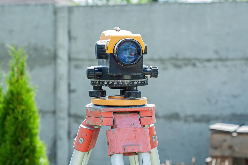
AUTO LEVEL
- SETTING UP THE TRIPOD
- CENTERING WITH OPTICAL PLUMMET
- LEVELLING
- FOCUSING THE TELESCOPE
- SETTING THE MEASUREMENT MODE AND PREPARING THE TARGET
- SETTING THE HORIZONTAL ANGLE
- SETTING TARGET HEIGHT AND INSTRUMENT HEIGHT
- SETTING THE STATION ELEVATION, CREATING A NEW JOB
- CHECKING AND ADJUSTING THE PLATE LEVEL, CIRCULAR LEVEL, OPTICAL PLUMMET
- TRIPOD SETTING, BUBBLE SETTING AND TILT SETTING
- CREATING NEW JOB/FILE, STATION, BACK SIGHT, FORE SIGHT AND POLE HANDLING
- MEASURING AND STORING POINTS, TAPE MEASUREMENT AND AREA SURVEY
- CHANGE POINT (CP) SHIFTING USING FORE SIGHT METHOD
- CHANGE POINT (CP) SHIFTING USING RESECTION METHOD, REM AND MLM
- SETTING OUT-USING COORDINATES
- SETTING OUT-USING DISTANCE AND ANGLE
- SETTING OUT-POINTS AT EQUAL LENGTH AND COLUMN MARKING
- LEVEL SHIFTING
- ANGLES AND AREA CALCULATION
TOTAL STATION
- SETTING UP THE TRIPOD
- CENTERING WITH OPTICAL PLUMMET
- LEVELLING
- FOCUSING THE TELESCOPE
- SETTING THE MEASUREMENT MODE AND PREPARING THE TARGET
- SETTING THE HORIZONTAL ANGLE
- SETTING TARGET HEIGHT AND INSTRUMENT HEIGHT
- SETTING THE STATION ELEVATION, CREATING A NEW JOB
- CHECKING AND ADJUSTING THE PLATE LEVEL, CIRCULAR LEVEL, OPTICAL PLUMMET
- TRIPOD SETTING, BUBBLE SETTING AND TILT SETTING
- CREATING NEW JOB/FILE, STATION, BACK SIGHT, FORE SIGHT AND POLE HANDLING
- MEASURING AND STORING POINTS, TAPE MEASUREMENT AND AREA SURVEY
- CHANGE POINT (CP) SHIFTING USING FORE SIGHT METHOD
ARCGIS
- INTRODUCTION TO ARCGIS
- DATA MANAGEMENT (RASTER DATA, VECTOR DATA, GEODATABASE, SHAPEFILES AND ATTRIBUTE QUERY)
- MAPPING AND VISUALIZATION (STYLING, MANAGING AND DISPLAYING LAYER)
- RASTER DATA ANALYSIS (SLOPE, HILLSHADE AND DEM)
- VECTOR DATA ANALYSIS (INTERSECT, BUFFER, UNION AND CLIP)
- GEO-STATISTICAL ANALYSIS TECHNIQUE (SPATIAL ANALYSIS AND NETWORK ANALYSIS
DGPS
- INTRODUCTION
- SETTING UP THE RECEIVER
- DATA TRANSFERRING
- GENERAL OPEARATION
- CABLE AND CONNECTORS
- BASE, ROVER, GPS CONNECTION AND SETTINGS
- GPS OPERATING AREA SURVEY
- DGPS SURVEY
- SETTING OUT
- DATA DOWNLOADING, DATA PROCESSING, CONVERTING DATA FORMAT INTO AUTOCAD FORMAT
